Le Turonien de Normandie et des confins picards. Volume 1. Stratigraphie générale. Strarigraphie du littoral
DOI:
https://doi.org/10.2110/carnets.2026.0001Keywords:
Turonian, Normandy, Picardy, stratigraphyAbstract
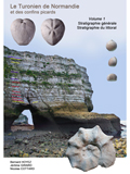
Cet ouvrage constitue la première partie d'une monographie du Turonien de Normandie et de ses confins picards, fondée sur des levés de terrain systématiques le long de 130 km de falaises littorales entre la Seine et la Somme. Il couvre l'intégralité de l'étage, du Turonien inférieur (zones à Fagesia catinus et Mammites nodosoides ) jusqu'au Turonien supérieur terminal (hardgrounds Navigation, limite Turonien/Coniacien). Il intègre également localement le Coniacien inférieur. Les observations lithostratigraphiques sont combinées à la biostratigraphie (ammonites, inocérames, brachiopodes, échinides). Elles sont mises en parallèle avec d'autres référentiels biostratigraphiques (micro et nannofossiles) ou chimiostratigraphiques. Les repères événementiels (hardgrounds, bentonites ou horizons marneux, niveaux de silex) sont calés sur la nomenclature de référence anglo-normande permettant des corrélations précises à l'échelle du Bassin Anglo-Parisien. La série est subdivisée en huit intervalles lithostratigraphiques, chacun délimité par des marqueurs événementiels identifiables sur le terrain. Six secteurs géographiques clés sont délimités. Des coupes de référence détaillées, originales pour certaines, sont établies. Leur complémentarité est montrée avec les coupes anglaises (Sussex, Wight, Kent). Ces coupes font apparaître une forte différenciation latérale entre les séries septentrionales (secteur Dieppe-Tréport, à faciès homogène et pauvres en silex) et méridionales (secteur Étretat-Fécamp, à sédimentation en « monticules et cuvettes » et fortes concentrations de silex), contrôlée par la tectonique synsédimentaire sur les linéaments varisques (Bray-Wight et faille de Lillebonne-Fécamp). De nouveaux niveaux repères locaux sont introduits, facilitant les corrélations entre secteurs. Des phénomènes associés à des horizons stratigraphiques particuliers sont détaillés, comme les slumpings, les éléments dissociés ou déplacés, les sheet-flints. Certains d'entre eux sont considérés d'origine paléosismique. Une synthèse paléoenvironnementale est proposée. Elle intègre le signal climatique (maximum thermique s’étendant en partie sur le Turonien inférieur, refroidissements Pewsey et Hitch Wood, baisse eustatique associée aux hardgrounds Navigation) et le signal tectonique (inversion précoce, hauts-fonds structuraux).
The Turonian of Normandy and of the Picard borderlands - Volume 1 - The coastline.- This work constitutes the first part of a monograph on the Turonian of Normandy and its Picardy borders, based on systematic field surveys along 130 km of coastal cliffs between the Seine and the Somme rivers. It covers the entire stage, from the Lower Turonian ( Fagesia catinus and Mammites nodosoides zones) to the uppermost Upper Turonian (Navigation hardgrounds, Turonian/Coniacian boundary). It also locally includes the Lower Coniacian. Lithostratigraphic observations are combined with biostratigraphy (ammonites, inoceramids, brachiopods, echinoids). They are correlated with other biostratigraphic (micro- and nannofossils) or chemostratigraphic reference frameworks. Event markers (hardgrounds, bentonites or marly horizons, flint levels) are calibrated against the Anglo-Norman reference nomenclature, allowing precise correlations across the Anglo-Paris Basin. The succession is subdivided into eight lithostratigraphic intervals, each bounded by event markers identifiable in the field. Six key geographical sectors are defined. Detailed reference sections, some of which are original, are established. Their complementarity with English sections (Sussex, Isle of Wight, Kent) is demonstrated. These sections reveal strong lateral differentiation between the northern series (Dieppe-Tréport sector, with a homogeneous facies and poor in flint) and the southern series (Étretat-Fécamp sector, with "mounds and troughs" sedimentation and high flint concentrations), controlled by synsedimentary tectonics along Variscan lineaments (Bray-Wight and Lillebonne-Fécamp fault). New local marker levels are introduced, facilitating correlations between sectors. Phenomena associated with specific stratigraphic horizons are detailed, such as slumpings, dissociated or displaced elements, and sheet-flints. Some of these are considered to be of paleoseismic origin. A paleoenvironmental synthesis is proposed. It integrates the climatic signal (thermal maximum extending partly into the Lower Turonian, Pewsey and Hitch Wood cooling events, eustatic fall associated with the Navigation hardgrounds) and the tectonic signal (early inversion, structural highs).
Downloads
Published
Issue
Section
License
Copyright (c) 2026 Carnets Geol.

This work is licensed under a Creative Commons Attribution-NonCommercial-ShareAlike 4.0 International License.