![]()
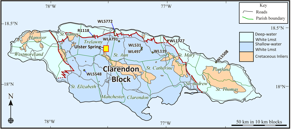
Figure 3:
Simplified geological map showing deep-water basins (minor blocks in eastern
and western Jamaica omitted) and the large, shallow-water Clarendon Block in
Oligocene to early Miocene times. Cretaceous rocks (inliers), parish boundaries,
and major roads are shown for reference. The location of the detailed map for
samples around Ulster Spring is shown (yellow box at exaggerated size) together
with other samples locations across Jamaica.