![]()
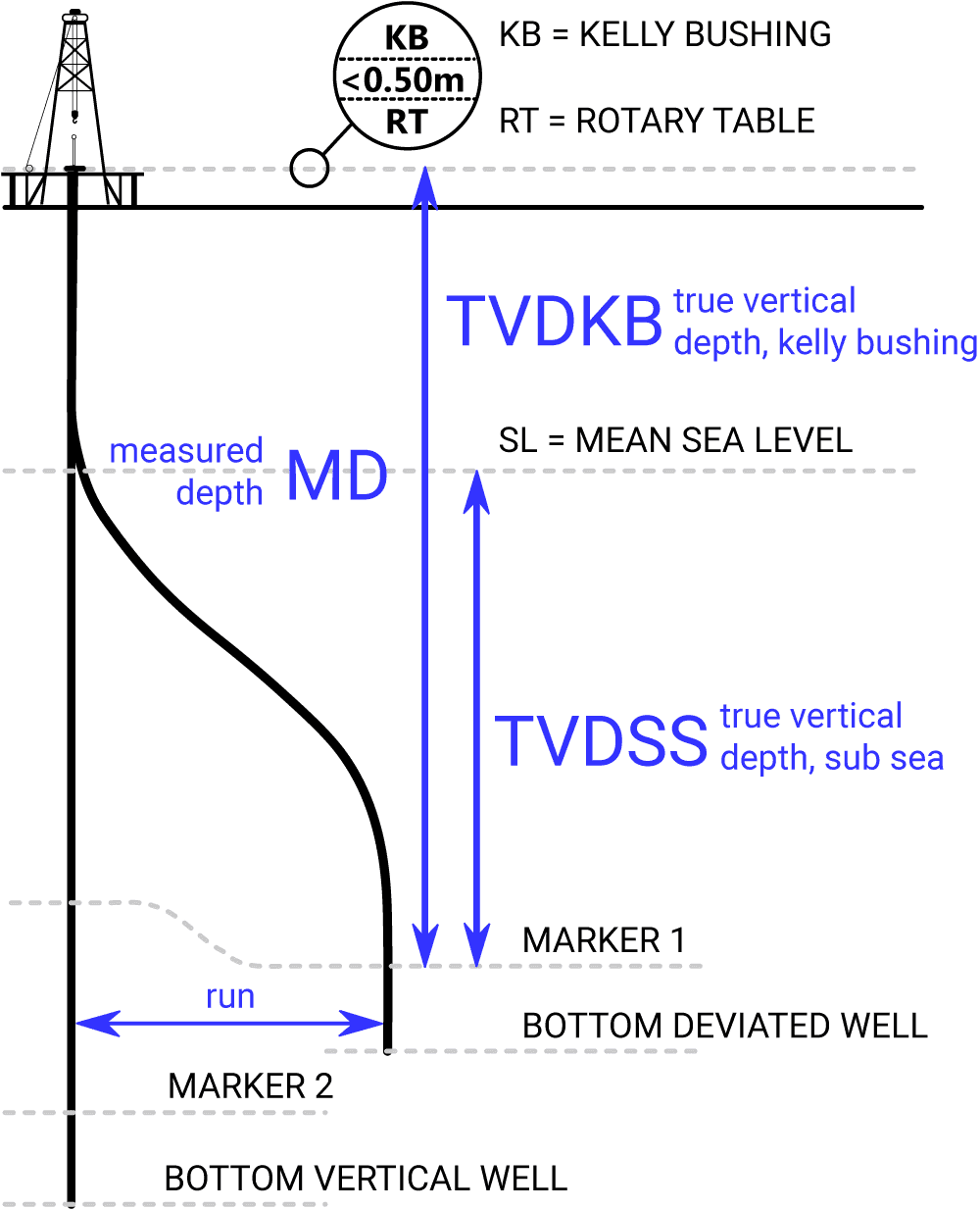
Figure 3: Schematic representation of vertical and deviated wells at the same location, showing the relationship between measured depth (MD), true vertical depth referenced to Kelly Bushing (TVDKB), true vertical depth referenced to the rotary table (TVDRT), and true vertical depth below mean sea level (TVDSS). The diagram also illustrates the GPS locations at the level markers, with the projections of the marker locations on a horizontal plane separated by a distance referred to as the run.